
When a client provides a ready-made primary BIM model, most managers and developers expect it to become a reliable basis for creating an executive As-Built model. In practice though, in the field of infrastructure design and reconstruction, this almost never corresponds to reality. The actual state of the object and the initial documentation almost always exist in parallel worlds.
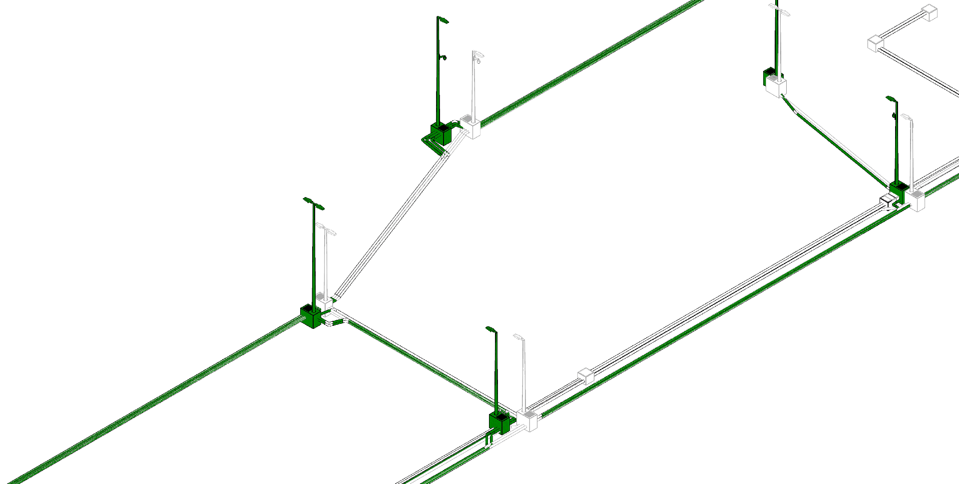
In this article, I will briefly outline a case study of how our The Heyon team completed work on a large-scale infrastructure project in Italy — a major transportation hub with an area of over 16,000 m² that included a public transport stop, capital canopy structures, a parking lot and an extensive network of underground and uppercase engineering utilities.
Our task was to develop a high-precision As-Built model of the architectural, structural and engineering parts based on laser scanning data. However, already at the stage of the primary audit, we faced a challenge that could delay the delivery dates by months.
The Problem: When the Point Cloud "Destroys" the Initial Model
Already at the start of the project, after importing and aligning the laser scanning data (Point Clouds) with the model provided by the client, it became clear: the initial files had critical discrepancies with the actual geometry. Mismatch of axes, displacement of structural elements, clashes between main pipelines and the new design — the actual state of the object differed significantly from the paper plans. The situation was complicated by two factors. First, the huge volume of data — 16,000 square meters of dense infrastructure where each element affects the functionality of the transportation hub. Second — tight deadlines. The object had to solve a complex and urgent local urban problem of the city, so there was no time for long deliberation.
The traditional approach to such a task is an endless, chaotic exchange of screenshots in messengers, hundreds of emails and regular coordination meetings that only consume budgets and time, which we rejected immediately. The project risked turning into a coordination hell. The solution we used was a transition to an open BCF format and cloud QA/QC. To build a transparent, fast and fully automated error-logging system, we abandoned static reports and implemented work through the open BCF (BIM Collaboration Format) format.
We structured the coordination process in such a way that instead of issuing a general list of chaotic comments to the client, the internal quality control group divided the object into critical areas of infrastructure and separate disciplines, recording each detected geometric or engineering deviation from the point cloud as a separate interactive task. Thanks to the implementation of the BCF format, each problem received a unique ID and a precise link to coordinates in the model space, so it was enough for a stakeholder or a modeler to click on the task in their software to automatically move their screen to the problem area at the right angle. Since BCF is an open openBIM standard, all further coordination and work took place in a single common data environment (CDE) without being tied to any one specific software, which allowed the team to work completely synchronously in a single information field, promptly exchanging comments, execution statuses and corrections.
Thanks to the automation of coordination processes and clear error logging through BCF, our team completely eliminated chaos at the modeling stage and delivered the As-Built model to the client on time with a zero rate of critical clashes. As a result, the client received an accurate executive layout that is 100% true to reality and the city received a full-fledged digital twin (Digital Twin) of the infrastructure facility with recorded parameters of all deviations, which allows for safe operation, maintenance and modernization of the hub in the future. The project became an example of successfully solving a complex urban problem without missing deadlines or incurring additional financial costs on the construction site.
This case once again proved an important truth: in complex Scan-to-BIM projects, the problem is usually hidden not in the quality of the laser scanner or the complexity of the geometry but in the deviation management process itself, where a properly selected coordination tool saves millions in budgets.